Station Navigation
Complete guide to navigating Tokyo’s biggest stations — Shinjuku, Shibuya, Tokyo, Ikebukuro. Exits, transfers, coin lockers, and apps.
Shinjuku connects several railway operators, so a station name alone is not enough to identify the right gate. Even locals get lost. If you’ve ever emerged from an underground maze blinking in confusion, wondering how you ended up on the wrong side of a highway — welcome to Tokyo station navigation.
Best for: First-time visitors, anyone transferring at Shinjuku, Shibuya, Tokyo, or Ikebukuro stations.
The Big 5 — Tokyo’s Most Confusing Stations
| Station | Lines | Exits | Difficulty | Tip |
|---|---|---|---|---|
| Shinjuku | 12 lines | 200+ | 🔴 Extreme | Use “East Exit” or “West Exit” as anchor — ignore numbered exits at first |
| Shibuya | 9 lines | 15+ (spread across buildings) | 🔴 Hard | Redevelopment can change walking routes — follow current signs and operator maps |
| Tokyo | JR lines including Shinkansen, plus Metro Marunouchi; nearby Otemachi is a separate station | 33 | 🟡 Moderate | Marunouchi side (west) = Imperial Palace. Yaesu side (east) = buses & shops |
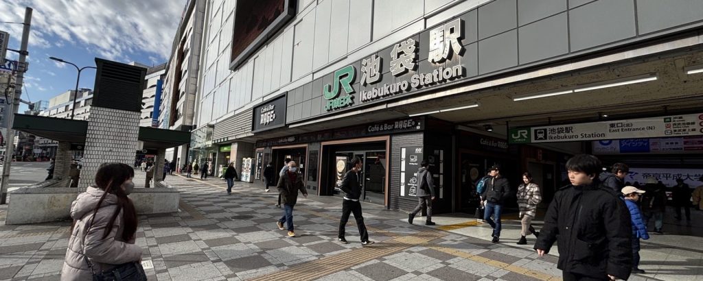
| Ikebukuro | 8 lines | 40+ | 🟡 Moderate | East = Sunshine City. West = Tobu Dept Store. Remember “West is Tobu, East is Seibu” (they’re swapped!) |
| Ueno | 7 lines | Many | 🟢 Manageable | JR and Metro stations are separate buildings — plan which one you need |
How to Read Station Signs
The Color-Letter-Number System
Where station numbering is shown, combine the line code and number with the operator and station name:
- Color = the line (e.g., Ginza Line = orange)
- Letter = line abbreviation (e.g., G = Ginza)
- Number = station position (e.g., G01 = Shibuya; G09 = Ginza on the Ginza Line)
Example: M-25 = Marunouchi Line (red), station 25 (Ikebukuro)
This system is your best friend. Even if you can’t read Japanese, follow the color and number.
Code examples checked 6 October 2026: Tokyo Metro Ginza Line station list.
Platform Signs
- Line symbols and directional arrows identify the platform. On Tokyo Metro signs, blue panels guide transfers; yellow panels guide exits.
- Floor stickers = door positions for each train (car 1, car 2, etc.)
- Overhead screens = next train, train type (local/express), and real-time delays
For the sign colors and arrows, see Tokyo Metro’s boarding guide.
Exit Signs
- Exits are labeled with numbers or compass directions (North, South, East, West)
- Major landmarks are listed next to exit numbers
- Look for the landmark you need, not the exit number — “Exit for Tokyo Tower” is easier than “Exit A4”
Transfer Survival Guide
Types of Transfers
| Type | What it means | Time | Example |
|---|---|---|---|
| Same-platform | Cross to the other side | 1 min | A signed same-platform interchange; check the service direction |
| Same-gate | Walk inside the gate area | 3–5 min | Ginza Line → Marunouchi Line at Akasaka-Mitsuke |
| Gate-to-gate | Exit one gate, walk, enter another | 5–10 min | JR → Metro at Ikebukuro |
| Station-to-station | Walk to a different station entirely | 5–15 min | JR Ochanomizu → Metro Shin-Ochanomizu (3 min walk) |
Notorious Transfers
Transfers That Take Forever
- Shinjuku: JR → Oedo Line — 10+ min underground walk with multiple staircases
- Shibuya: JR → Ginza Line — JR platforms are elevated on 2F; the Ginza Line platform is on 3F. Follow the signed connection between the operators.
- Tokyo: JR → Marunouchi Line — Straightforward but the walk is 500m+
- Otemachi ↔ Tokyo Station — Technically connected underground, but it’s a 10-min walk
- JR ↔ Keio at Shinjuku — Follow the signs for the correct Keio service and transfer gate. Keio has a JR connection; the route is not universally an outdoor crossing from JR South Gate.
Essential Apps & Tools
| App | Best for | English? | Free? |
|---|---|---|---|
| Google Maps | Door-to-door routing including walking inside stations | ✅ | ✅ |
| Jorudan | Train timetables, fare calculation, transfer details | ✅ | ✅ |
| Navitime | Station maps + walking routes inside stations | ✅ | ✅ (basic) |
| JR East App | Real-time crowding per car, JR station maps | ✅ | ✅ |
| Tokyo Metro App | Metro-specific station maps and real-time info | ✅ | ✅ |
Station-by-Station Cheat Sheet
Shinjuku Station 🟥
Mental model: Think of it as 3 separate zones:
- JR Zone (center) — Yamanote, Chuo, Sobu, Saikyo, Shonan-Shinjuku
- Subway Zone — Marunouchi is Tokyo Metro; Oedo is Toei. Their platforms and fare gates are separate. Follow the operator and line signs rather than assuming one “Metro” concourse.
- Private Railway Zone (edges) — Odakyu & Keio (South-West), Seibu (East)
Key landmarks by exit:
- East Exit → Kabukicho, entertainment
- South Exit / New South Exit → Expressway Bus Terminal, Odakyu
- West Exit → Metropolitan Government Building (free observation deck)
Shibuya Station 🟧
Warning: Station redevelopment can change passageways. Use the current JR and subway maps for the gate and line you need.
- Hachiko Exit → Scramble Crossing, Center-gai
- Miyamasuzaka side → the east side and Hikarie area. SHIBUYA109 / Dogenzaka are on the west side; the Metro map marks A2 for SHIBUYA109.
- Ginza Line has an elevated 3F platform above Meiji-dori, with a connection toward Hikarie. It is separate from the underground subway platforms.
- JR platforms are on 2F. Hanzomon / Tokyu Den-en-toshi use B3F; Fukutoshin / Tokyu Toyoko use B5F. Identify the line before choosing an escalator or gate.
Layout checked 6 October 2026 using JR East’s Shibuya map (June 2026) and Tokyo Metro’s Shibuya map (November 2025). Check current work notices before travelling.
Tokyo Station 🟩
Simple rule: Marunouchi side = west, Yaesu side = east.
- Marunouchi side → Imperial Palace, brick station building (photo spot)
- Yaesu side → Highway buses, shops, restaurants
- Shinkansen → Always on the Yaesu side
- Keiyo Line (to Disneyland) → 500m underground walk from main concourse. Allow 15 min.
Practical Tips
Pro Tips
- Screenshot your route before entering the station — cell signal can be weak underground
- Follow the line color on the floor or walls — colored strips lead you to the right platform
- Station staff at the gate booth speak basic English and can point you in the right direction
- “Which exit for ___?” — Ask this at the booth; they’ll point you to the right exit
- Coin lockers are near ticket gates — look for signs saying “コインロッカー”
- Wrong gate? Ask gate staff before re-entering. An accidental exit does not guarantee free re-entry. The 60-minute IC transfer window applies to designated out-of-gate interchanges, not a general stopover. Ending a trip and entering again can incur another fare.
- Ticket type matters: For a regular paper-ticket transfer between Metro lines that requires leaving the paid area, use the orange transfer gate, keep the ticket and re-enter within 60 minutes. A magnetic through-ticket to another operator follows different rules; ask staff if unsure.
- Barrier-free routes : Most stations have elevator routes, but they can be hard to find. Ask staff or check the station map.
Transfer conditions checked 6 October 2026: Tokyo Metro designated interchange list; current IC-card rules; magnetic Metro–Toei through-ticket rules.
For specific rail decisions, continue to our Tokyo Metro vs Toei guide and Tokyo train delays guide.
FAQ
What if I exit the wrong gate with my Suica?
If you leave through an unintended gate or your Suica will not open a gate, speak to station staff and explain where you entered and travelled. They can check the entry record and any fare due. Do not assume a machine can undo the exit or that another entry will be free. Tokyo Metro’s IC-card rules distinguish a designated transfer from ending a trip or leaving the same station without riding.
Is there Wi-Fi in stations?
Availability varies by station and operator. As checked on 7 October 2026, Tokyo Metro’s official Wi-Fi page says Metro_Free_Wi-Fi is suspended for equipment upgrades. Download your route and station map in advance, and keep mobile data available rather than relying on station Wi-Fi.
How do I find the right exit for my hotel?
Start with your hotel’s official access directions and match both the station and exit on the operator’s map. A route-planning app can help, but check the final exit signs on site. With luggage or a stroller, choose a step-free exit rather than the first exit you see.
Are station maps available in English?
Yes. Tokyo Metro, Toei, and JR East all publish English station maps on their websites and apps.
Explore More Tokyo Guides
For neighborhood-specific tips on where to stay and what else to explore nearby:


